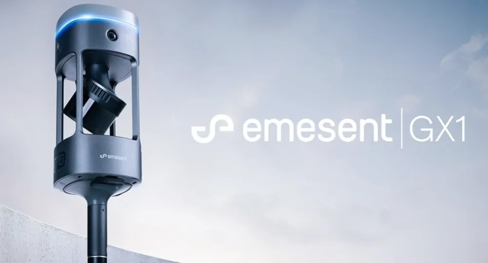
Global autonomous mapping technology leader Emesent has officially launched the Emesent GX1, an all-in-one SLAM LiDAR, RTK and 360° imagery scanner designed to deliver survey-grade accuracy with the speed of mobile scanning.
The GX1 sets a new industry benchmark as the world’s most accurate integrated Simultaneous Localization and Mapping (SLAM) and Real-Time Kinematic (RTK) scanner, achieving independently validated 5–10mm global accuracy. The breakthrough gives surveyors and Architecture, Engineering and Construction (AEC) professionals the precision they require—without sacrificing speed.
A Breakthrough in Speed and Verified Accuracy
For decades, survey firms have faced a trade-off between rapid mobile data capture and dependable, provable survey-grade accuracy. The GX1 eliminates that compromise by integrating LiDAR, RTK, cameras and processing software into a seamless, end-to-end workflow—from capture to validated deliverable.
The system can reduce site survey time by up to 95%, transforming projects that previously required weeks of fieldwork into a single day of scanning. This acceleration is particularly impactful for large-scale infrastructure, road surveys, topographic mapping and Scan to Building Information Modeling (BIM) applications.
“With the introduction of the GX1, we’ve answered the call we’ve heard echoing throughout the surveying industry to end the tug-of-war between fast and accurate,” said Dr. Stefan Hrabar, Chief Strategy Officer and Co-Founder of Emesent. “By putting the power of SLAM into the hands of the everyday surveyor, the GX1 raises the bar for mobile scanning accuracy and keeps critical projects on track.”
Built on Proven SLAM Technology
The GX1 leverages Emesent’s proprietary SLAM algorithm—the same technology powering the award-winning Emesent Hovermap. Originally developed and validated in GPS-denied underground and extreme environments, the SLAM engine is engineered for repeatable accuracy both indoors and outdoors.
This foundation enables the GX1 to maintain reliability across diverse project conditions, from dense urban construction sites to open road corridors and complex infrastructure environments where other mobile SLAM systems may struggle.
Designed for Practical Field Deployment
The GX1 was built with both accessibility and flexibility in mind. It supports four purpose-built deployment modes:
- Backpack
- Survey pole
- Vehicle mount
- Supported handheld
Surveyors can capture georeferenced data in real time using integrated RTK or apply Ground Control Points and checkpoints during post-processing, minimizing the risk of costly return site visits.
The system also features:
- Independently validated 5–10mm global accuracy
- Integrated RTK georeferencing with real-time quality monitoring
- Four 20MP cameras delivering 360° panoramic imagery
- Integrated batteries for cable-free operation
- Rapid accuracy validation reporting within Emesent’s Aura processing software
Addressing Industry Workforce Pressures
The launch comes at a critical moment for the surveying and AEC industries. Firms are contending with a shortage of experienced surveyors while clients demand faster turnaround times, reduced costs and uncompromised quality.
By simplifying advanced mobile mapping into an all-in-one platform that junior surveyors can learn and deploy within days, GX1 helps firms increase operational capacity without lowering standards. At the same time, it restores competitive differentiation in a market where basic mobile scanning is becoming commonplace.
The GX1 is being showcased at Geo Week 2026, where attendees can visit Emesent at booth #911 to see the system in action.
With the GX1, Emesent positions itself at the forefront of next-generation survey technology—merging speed, validation and survey-grade precision into a single, field-ready solution.
Originally reported by Emesent.