MYRTLE GROVE, La. — The U.S. Army Corps of Engineers (USACE) New Orleans District has begun construction of an underwater sill across the Mississippi River near River Mile 64, aiming to slow the upriver movement of saltwater from the Gulf of Mexico. The project is intended to protect municipal and industrial water supplies threatened by saltwater intrusion, which can worsen during periods of low river flow.
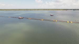
Weeks Marine of Cranford, N.J., was awarded the contract to build the sill. The first phase will install the structure at an initial elevation of -55 ft, after which USACE will monitor the saltwater wedge to determine whether the sill needs additional height to meet mitigation goals.
“The construction of this sill is critical for protecting water supplies while allowing continued navigation along the nation’s busiest inland waterway,” USACE stated in an Oct. 1 release.
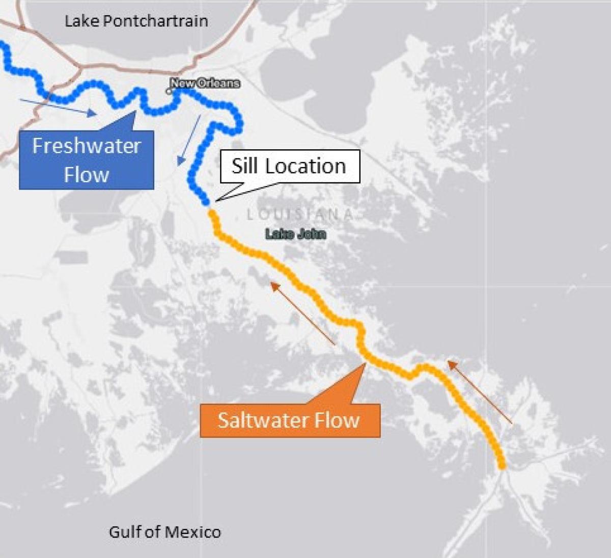
Saltwater intrusion is a naturally occurring phenomenon in the Mississippi River. Because the riverbed between Natchez, Miss., and the Gulf lies below sea level, denser Gulf saltwater can move upriver along the bottom of the channel beneath lighter freshwater. Under normal conditions, the river’s flow prevents significant intrusion, but periods of low water volume allow saltwater to progress upstream, posing risks to drinking water systems and industrial operations.
The sill is part of mitigation efforts required due to the deepening of the Mississippi’s shipping channel from 40 ft. to 45 ft., with future plans to reach 50 ft. The structure is designed to act as a reservoir, temporarily holding saltwater and preventing it from moving further upriver. Similar underwater sills have been built in 1988, 1999, 2012, 2022, 2023, and 2024 to control saltwater during low-flow periods.
“In 2023, we had to augment the previous sill from -55 ft. to -30 ft. after saltwater overtopped the structure,” the release said. “A 620-ft.-wide navigation lane remained at -55 ft. to ensure deep-draft shipping continued.”
USACE engineers explain that saltwater forms a wedge beneath freshwater due to density differences, and its progression is influenced by river flow, tides, winds, temperature, and channel slope. When freshwater flows increase, the saltwater wedge retreats downstream, but it advances during low flow periods. Properly engineered sills can stabilize the wedge and prevent damage to critical water infrastructure.
“By carefully monitoring the sill and the river’s flow, we aim to maintain a balance that protects communities while allowing commercial navigation to continue safely,” the agency said.
The project demonstrates the ongoing efforts of USACE to mitigate environmental and operational impacts of river deepening while safeguarding municipal water supplies, industrial operations, and navigation along the Mississippi River corridor.
Originally reported by USACE New Orleans District in Construction Equipment Guide.